 Wayfound

Grid search coordination
Run a missing-person search from one live map.
One shared picture for the command post: the subject, the grids, how much of each has really been searched, and where every searcher is right now. Searchers get a phone app for their grid, clues and SOS that keeps working out of signal.
Runs in any browser, with native iPad and iPhone apps in testing. Searchers need no account: they scan a QR code.
Open the search
The subject, last known position, command post and briefing. Grid the map in a minute.
Check volunteers in
They scan a QR code, sign in with an emergency contact and the waiver, and get their grid on their phone.
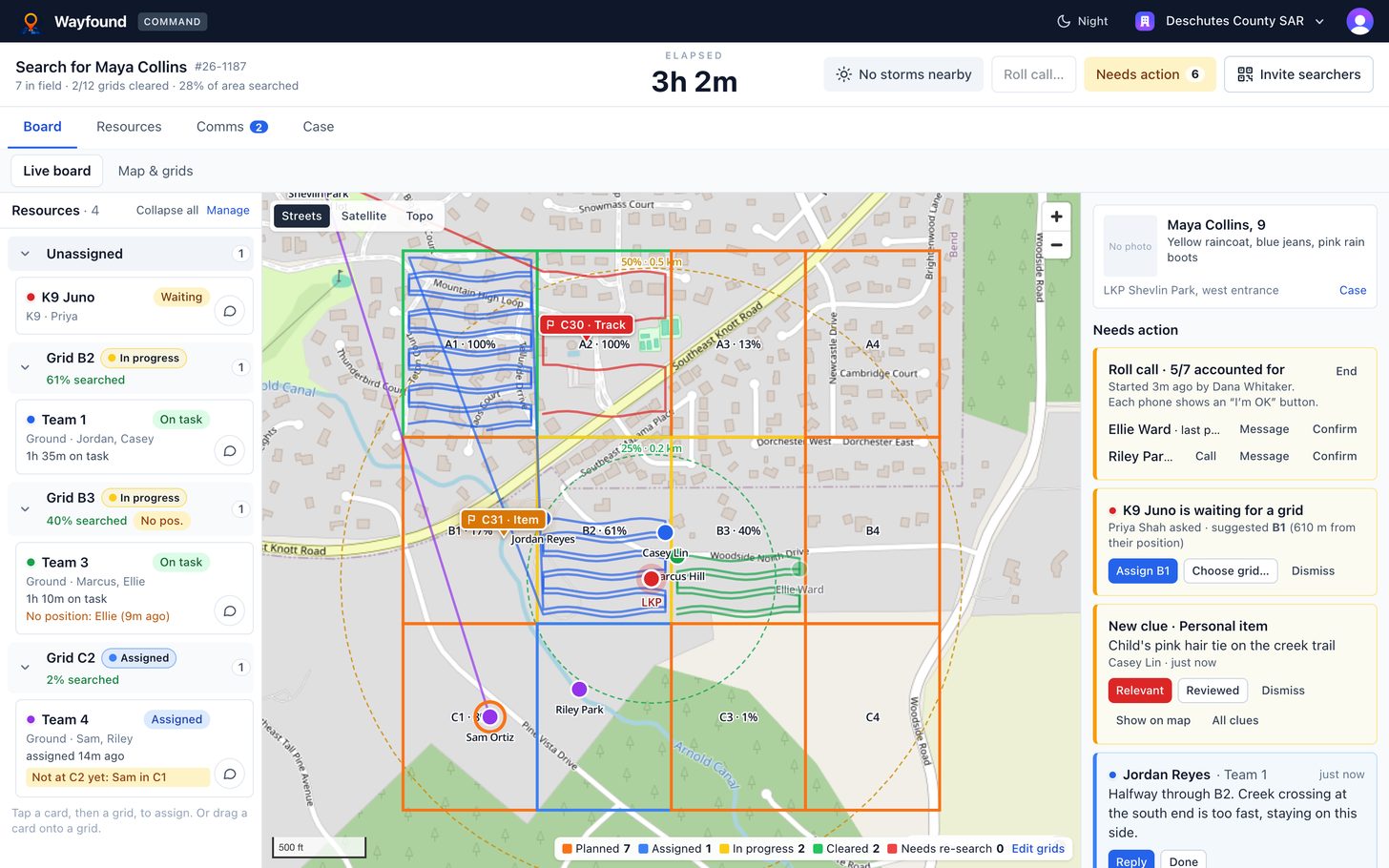
Run it from one board
Live positions, coverage, alerts, weather and roll call. Reassign as you learn, then print the after-action report.
What's in the box
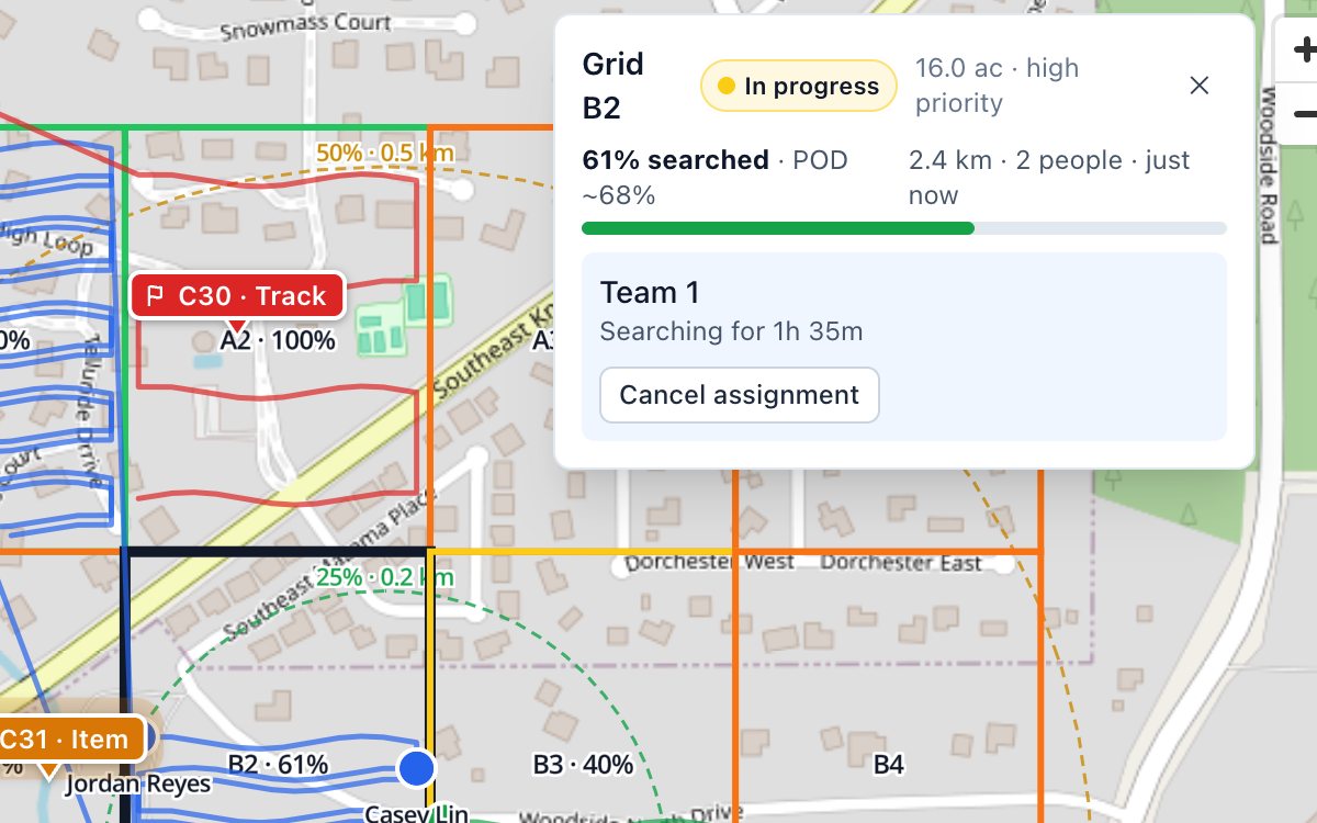
Search coverage, measured
Every GPS track becomes searched ground. Each grid shows the share actually covered and an estimated probability of detection.
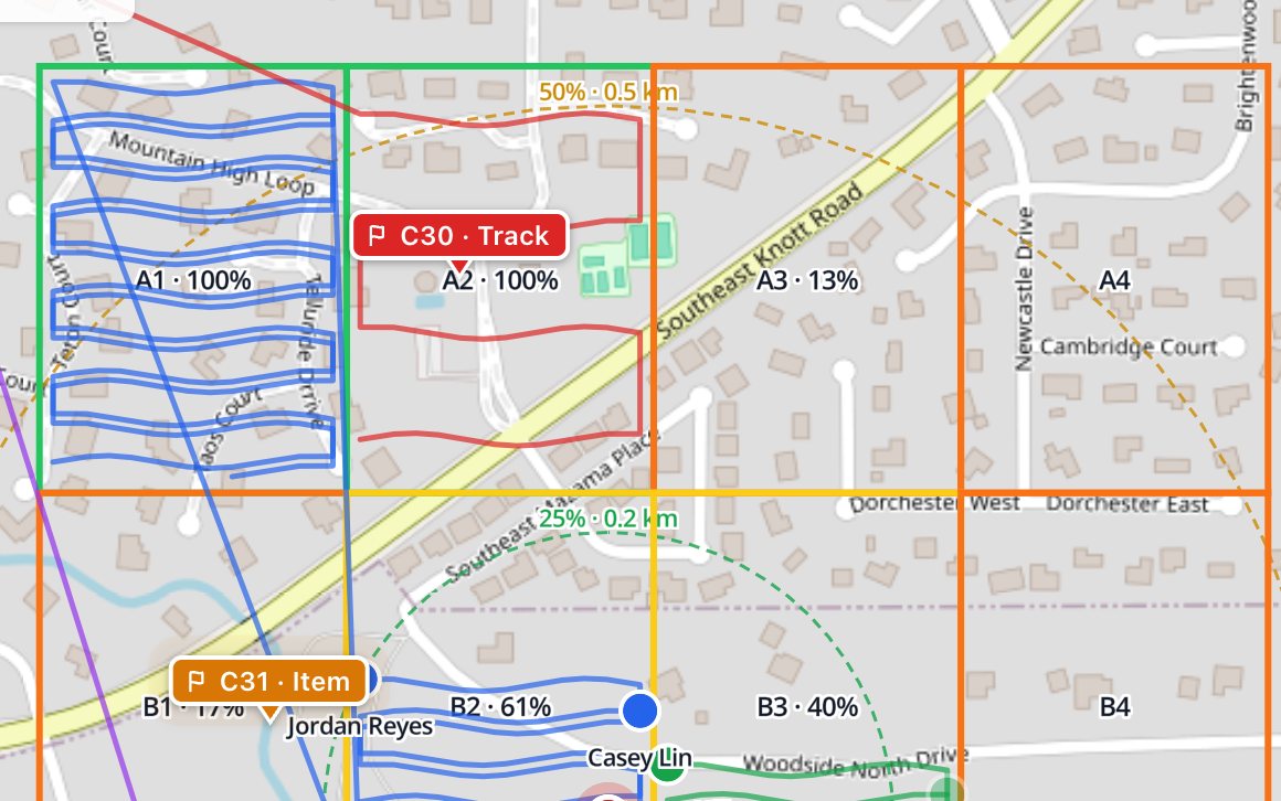
Live positions & trails
Every phone reports its position, even in a pocket. Trails show where teams really went, grid by grid.
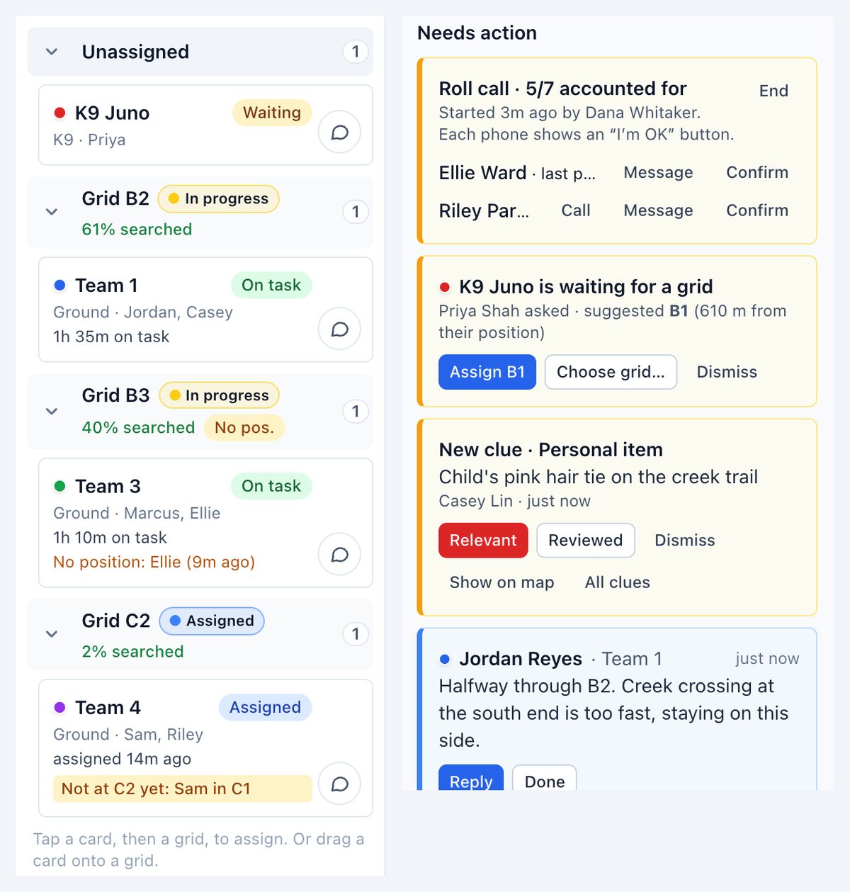
One queue for what needs action
SOS, grid requests, new clues, field messages, people outside their grid and phones gone quiet, each with the next step.
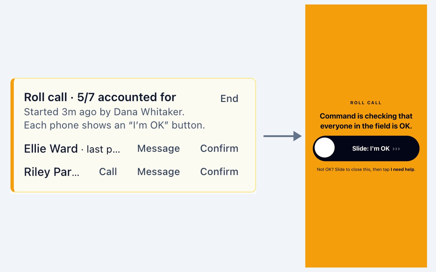
Roll call
One tap asks everyone in the field to confirm they’re OK. See who hasn’t answered, and confirm by radio.
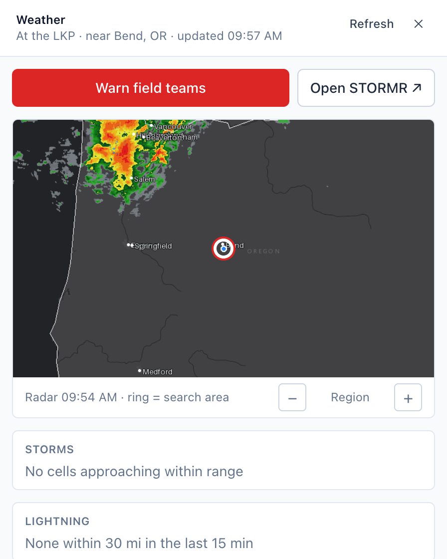
Weather at the search
Approaching storms and lightning from STORMR, NWS alerts, hourly forecast and sunset, with a zoomable radar picture.
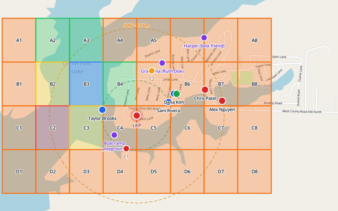
LKP, command post & behavior rings
Place the last known position and the command post on the map. Lost-person rings show where people like the subject are found.
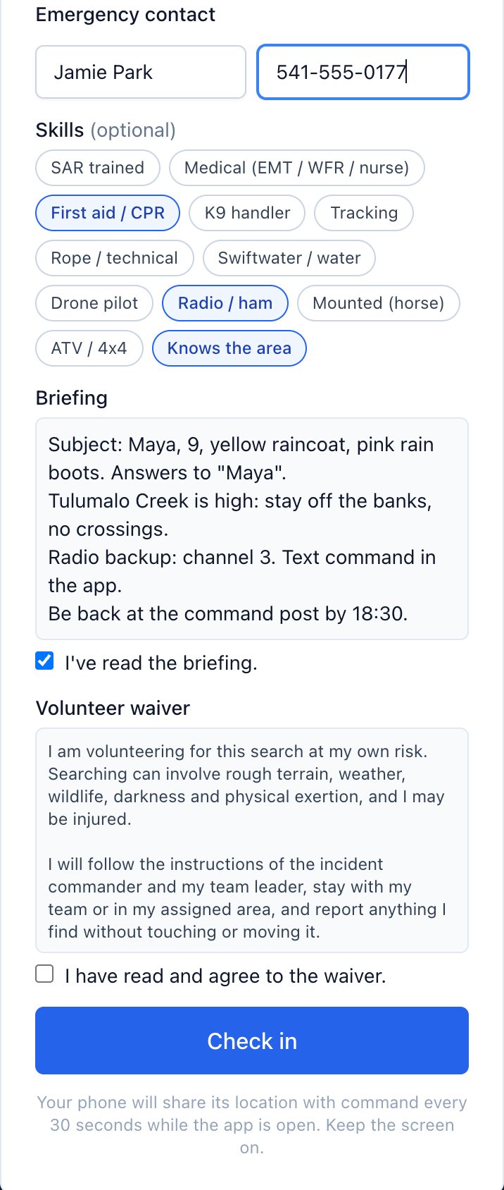
Volunteer sign-in
Scan the QR code: emergency contact, skills, the briefing and the waiver, recorded before anyone heads out.
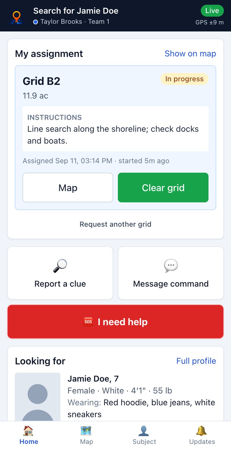
Field app that works without signal
Their grid, directions, clues and SOS. With no signal, positions, clues and messages wait on the phone and send on reconnect.
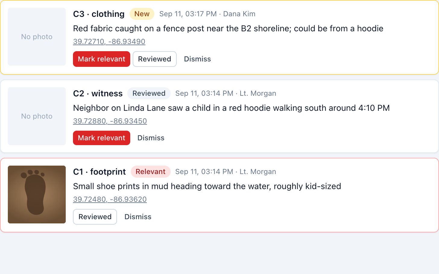
Clues, messages & SOS
Pins and photos from the field, triaged at command. Message one person, a team or everyone. Hold-to-send SOS.
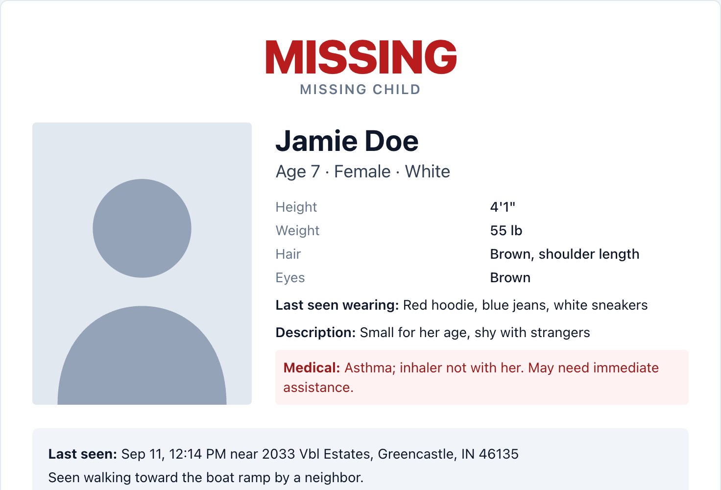
Subject profile & BOLO flyer
Photo, description, clothing and medical needs. Print a flyer with the join QR code in one click.
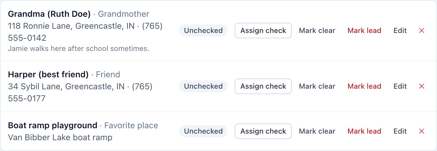
Known contacts & address checks
Family, friends and favorite places, each taskable as an address check.
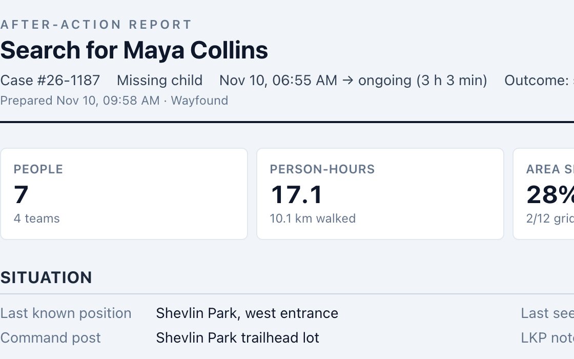
After-action report
Coverage map, grids, clues, personnel hours, roll calls and the full timeline. Add your review notes and print to PDF.
Command post
Build the incident, run grids and resources, watch coverage and weather, take roll calls, and print the flyer and after-action report. In the browser, or the native iPad app.
Sign in to command →Field app
Scan the QR code, sign in, and you're on the search: your grid, the subject, updates, clues and SOS. Works in the browser or the iPhone app, and keeps working without signal.
Join a search →